PHOTOGRAMMETRY SERVICES
ADVANCED 3D DIGITIZATION TECHNOLOGY
Photogrammetry is a sophisticated technological process that transforms multiple 2D photographic images into precise 3D digital models. This methodology employs specialized algorithmic software to analyze photographs captured from various angles, identifying common reference points to generate accurate three-dimensional representations of physical objects and environments.
TECHNICAL IMPLEMENTATION
Our photogrammetry workflow incorporates:
Multi-angle high-resolution image capture
Advanced computational processing
Point cloud generation and refinement
Mesh creation and optimization
Texture mapping for photorealistic rendering
Measurement calibration and verification
APPLICATIONS ACROSS INDUSTRIES
This technology provides significant value across multiple sectors including:
Architectural documentation and preservation
Construction and civil engineering
Archaeological research and heritage conservation
Industrial component digitization
Environmental monitoring and analysis
Digital asset creation for virtual environments
PRECISION ADVANTAGES
The primary advantage of our photogrammetry services lies in their exceptional accuracy. Our systems capture precise spatial measurements and detailed surface characteristics, producing meticulously faithful digital representations of physical objects and environments with millimeter-level precision.
COLLABORATIVE APPROACH
We prioritize close client collaboration throughout the digitization process, customizing our technical parameters to address your specific requirements. Our specialists provide comprehensive support from initial consultation through final delivery, ensuring optimal results for your application context.
SPECIALIZED EXPERTISE
Our team of photogrammetry specialists brings technical proficiency and industry-specific knowledge to every project. Whether your requirements involve construction documentation, engineering analysis, or survey verification, our expertise ensures deliverables that meet professional standards across technical disciplines.
Contact our technical team to discuss how our photogrammetry capabilities can support your dimensional documentation requirements.
Orthophoto Photogrammetry
Orthophoto photogrammetry is an advanced technique that combines the precision of surveying with the rich detail of aerial photography. By producing high-resolution, georeferenced images known as orthophotos, this method enables accurate and detailed mapping of terrain, infrastructure, and land cover. Used in various fields such as urban planning, environmental monitoring, and agriculture, orthophoto photogrammetry provides unparalleled insights into our ever-changing world.
This example below is rendered at 5% resolution. Real image resolution is 45719x29742 pixels
Key Features of Orthophoto Photogrammetry:
Accuracy: Orthophotos are created by correcting aerial photographs for distortions caused by camera tilt, topographic relief, and lens aberrations. The result is a highly accurate and distortion-free image that maintains a uniform scale across the entire surface.
Georeferenced: Each orthophoto is georeferenced, meaning it is precisely aligned with real-world geographic coordinates. This allows for seamless integration with Geographic Information Systems (GIS) and easy comparison with other geospatial data, such as topographic maps, satellite imagery, and LiDAR.
High-resolution: Orthophoto photogrammetry captures images with incredible detail, revealing features and patterns that may be missed in conventional aerial photography or satellite imagery. This high-resolution data is invaluable for applications such as land use analysis, infrastructure planning, and environmental assessments.
Versatile applications: Orthophoto photogrammetry is used across a wide range of industries and disciplines, including urban planning, agriculture, forestry, environmental monitoring, disaster response, and civil engineering. Its accuracy and detail make it a powerful tool for decision-making and analysis.
Depth Mapping
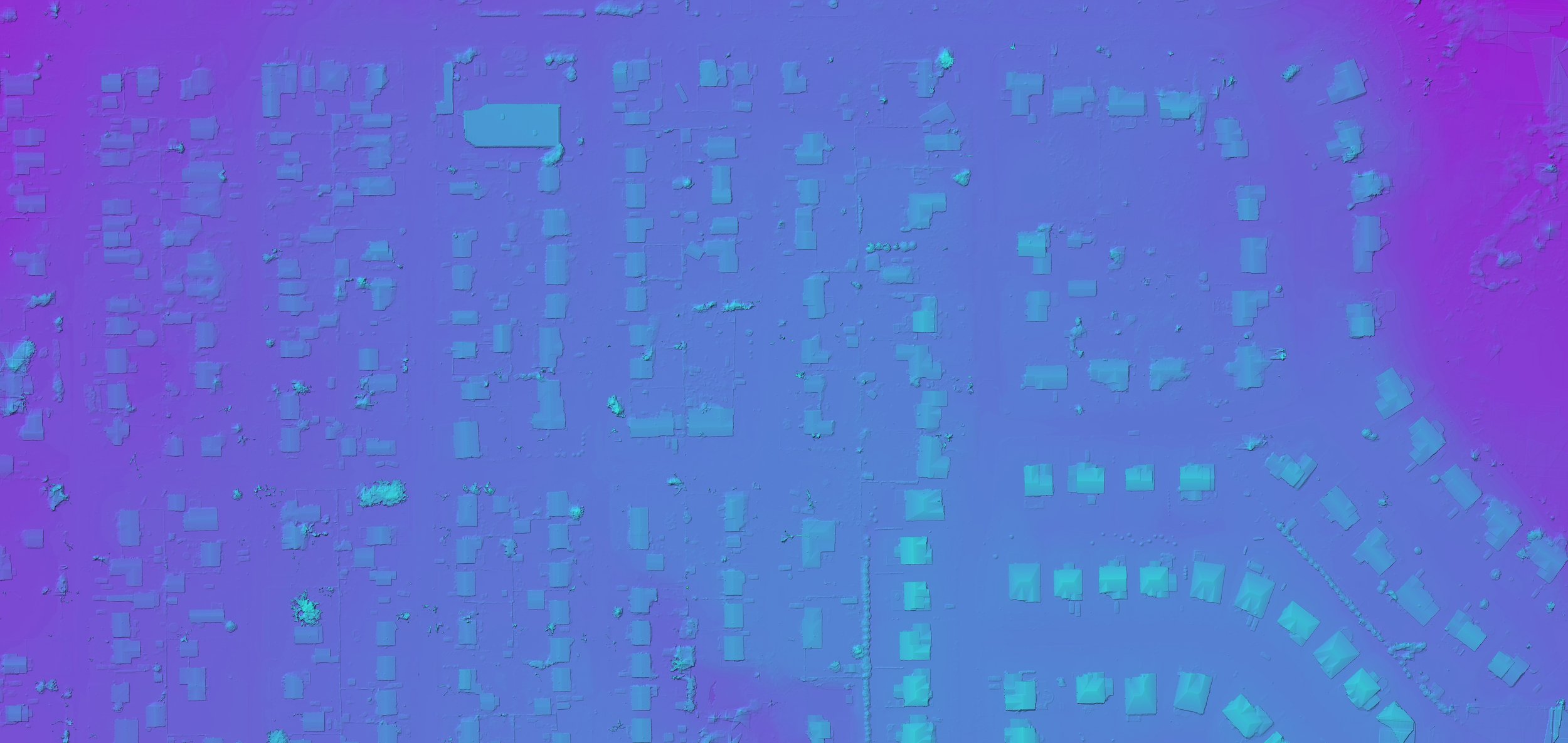
Depth mapping photogrammetry is a cutting-edge approach that utilizes stereo imagery to create highly accurate and detailed three-dimensional models of terrain and other objects. By reconstructing the depth information from multiple overlapping photographs, this method provides valuable insights for various applications such as geological analysis, infrastructure planning, and environmental management. Depth mapping photogrammetry allows us to explore and understand our world in entirely new ways.
Note: This example below is rendered at 3% resolution. Full image resolution is 45719x29742 pixels
Key Features of Depth Mapping Photogrammetry:
3D visualization: Depth mapping photogrammetry produces detailed 3D models that enable visualization and analysis of terrain, buildings, and other features from any angle. These interactive models help users gain a more comprehensive understanding of the spatial relationships and topography of an area.
Digital Elevation Models (DEMs): One of the primary outputs of depth mapping photogrammetry is a Digital Elevation Model (DEM). A DEM represents the Earth's surface, including terrain and other natural features, as a continuous grid of elevation values. DEMs are widely used in GIS applications, flood modeling, and land use planning.
High precision: By using sophisticated algorithms to match corresponding points in overlapping images, depth mapping photogrammetry achieves impressive levels of accuracy and precision. This level of detail is essential for applications that require a high degree of accuracy, such as engineering projects or geological analysis.
Broad applications: Depth mapping photogrammetry is utilized across diverse industries and disciplines, including archaeology, geology, forestry, mining, and transportation. Its ability to create accurate 3D models makes it an invaluable tool for decision-making, analysis, and research.


